01
In the pilot
In the pilot
From orbit
Twenty-five years of optical and radar records for the whole reserve: how much forest, in what condition, lost where and when.
Kanopy · pilot programme
How much forest a reserve holds, what condition it is in, and where it is being lost. Read from orbit first, then flown and walked.
For the people who answer for a forest
Nigeria has about a thousand forest reserves, owned by its states. Most have no current record of how much forest is left inside the line, or where it is going. Without a measurement someone else can check, a reserve cannot be managed, financed or defended.
Kanopy is that measurement. It is in pilot: two reserves have been read from orbit so far, and nobody has yet walked either one for us. The reports say so where it matters.
Twenty-five years of optical and radar records for the whole reserve: how much forest, in what condition, lost where and when.
Drone lidar flown in strips, to measure the height and structure of the canopy where a satellite only sees green.
Trees measured by hand in sample plots. Every carbon figure is calibrated to them; none is credible without them.
Small devices that recognise a chainsaw or a truck where they stand and alert rangers in minutes, with no connection to the cloud.
Pilot report one · Omo Forest Reserve, Ogun State
A land-cover map calls 97.7% of Omo tree cover. The longer record tells a different story: most of that is forest that has been logged or thinned, and the clearing is spread through the interior, not along the edge where a patrol would look.
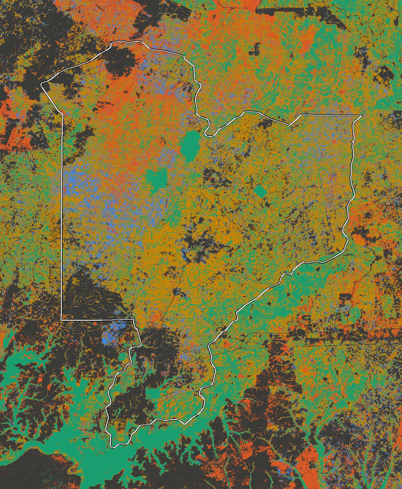
14,920 ha since 2001. The largest year is 2025, at 1,499 ha; the latest year is provisional.
Pilot report two · Pandam Wildlife Park, Plateau State
Pandam is intact savanna woodland in a farmed landscape, holding 2.7 times the biomass per hectare of the land around it. For 23 years almost nothing changed. Then 321 ha went from one corner in two years. One image cannot say whether it was felling, farming or fire.
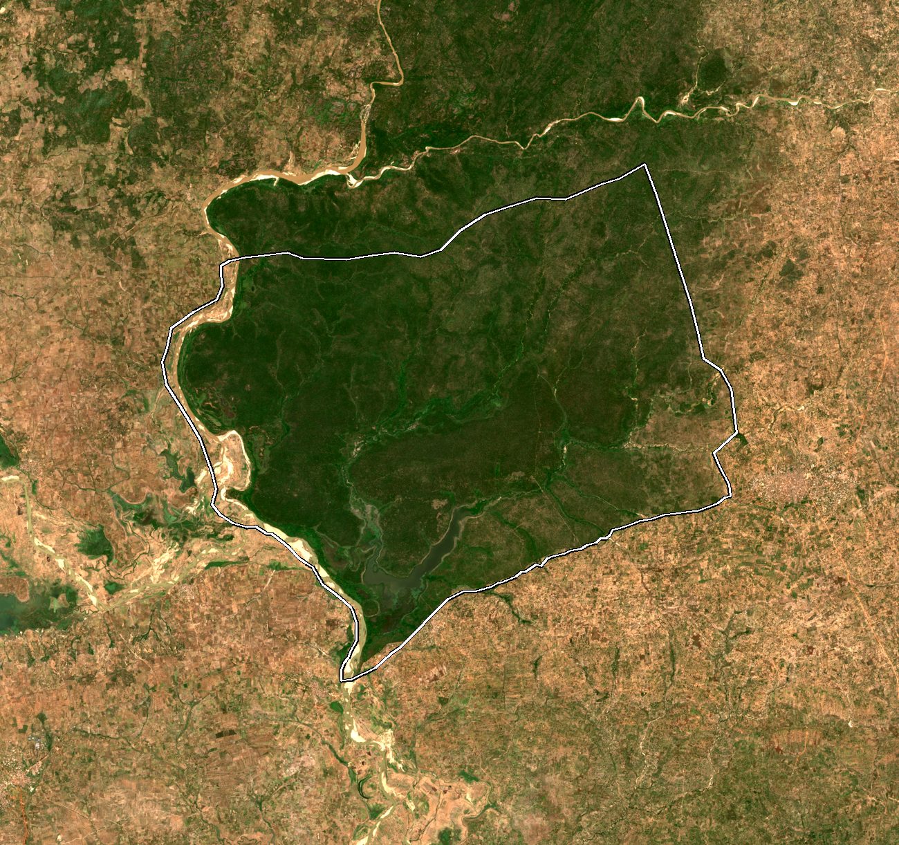
440 ha since 2001, of which 73% in the last two years. The latest year is provisional.
Kam Origin · cocoa in Ondo and Cross River
From December 2026 an EU importer must show its cocoa was not grown on forest cleared after 2020, and was farmed legally. We ran that test on 20 mapped cocoa farms, four estates and four forest reserves. Most farms pass the forest test or need a field visit to decide. Eight of the twenty sit inside a gazetted forest reserve.
Who it is for
Kanopy runs on the same foundation as the rest of Kam Edge: models that work on the device, in places without reliable power or signal. The measurement is independent of whoever owns, manages or finances the reserve.
A current picture of every reserve you hold, and notice when one starts to change.
A record of the reserve you manage that a funder can verify without taking your word for it.
Independent measurement before you commit to a forest, including natural-asset and carbon structures.
Join the pilot
We are looking for one state authority or conservation partner to take a reserve into the next stage. If you manage a reserve, or hold records that would correct either report, we would like to hear from you.
Join the pilot
Tell us who you are and which reserve you have in mind. We come back with what a first survey of it would involve — or with corrections to a report, if that is what you are writing about.